Road Trips
Yukon Road Trip: From the Pacific to the Arctic Ocean
A 15-day Yukon road trip from Haines and Skagway on the Pacific to Tuktoyaktuk on the Arctic Ocean, with daily stages, distances and fuel tips.
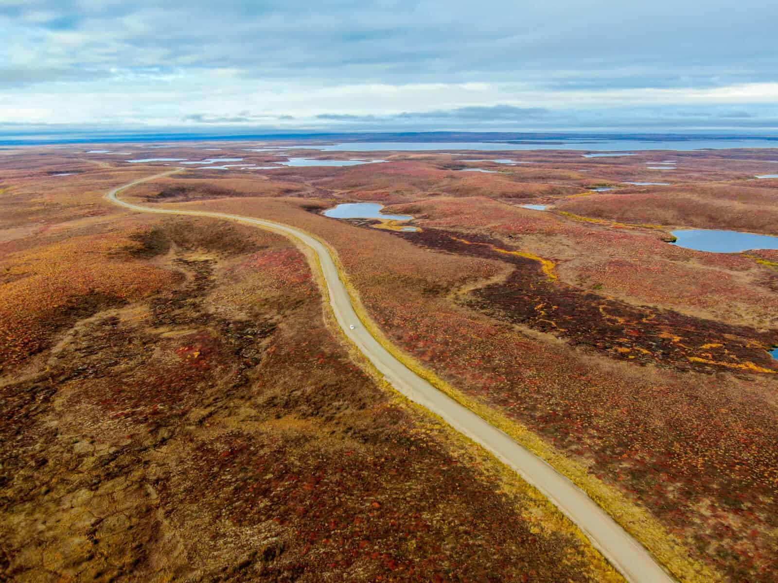
This route starts in Whitehorse, runs south to the Pacific at Haines and Skagway in Alaska, then turns north across the whole of Yukon to Tuktoyaktuk on the Arctic Ocean. It uses the great roads of the north: the Alaska Highway, the Haines Road, the Klondike Highway, the Robert Campbell Highway, the Dempster Highway and the Inuvik to Tuktoyaktuk Highway.
We drove it with Tobi, a German-born Yukoner and our guide from the Whitehorse tour company EPIC NORTH Tour Experiences, and we describe the stages below as you would drive them on your own. Along the way you meet First Nations and Inuit communities, follow the Klondike Gold Rush and the building of the Alaska Highway, and see how fast climate change is reshaping the north.
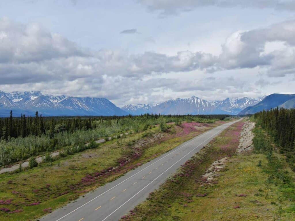
The Route at a Glance
| Day | Stage | Distance |
|---|---|---|
| 1 | Arrive in Whitehorse | |
| 2 | Whitehorse to Haines Junction, side trip to Kluane Lake | 158 km plus about 140 km return |
| 3 | Haines Junction to Haines, Alaska | 246 km |
| 4 | Haines: bears, eagles and seals | local |
| 5 | Ferry Haines to Skagway | about 1 hour by ferry |
| 6 | Skagway to Whitehorse via Carcross | about 180 km |
| 7 | Whitehorse to Watson Lake | 436 km |
| 8 | Day trip to Liard River Hot Springs, BC | about 420 km return |
| 9 | Watson Lake to Carmacks on the Robert Campbell Highway | 583 km |
| 10 | Carmacks to Dawson City | about 355 km |
| 11 | Dawson City and the Klondike goldfields | local |
| 12 | Dawson City to Eagle Plains on the Dempster Highway | 406 km |
| 13 | Eagle Plains to Inuvik | 367 km |
| 14 | Inuvik to Tuktoyaktuk and back | 276 km |
| 15 | Fly from Inuvik to Whitehorse |
That adds up to about 3,600 kilometres of driving, roughly 1,400 of them on gravel. The best time is late June to late August, when all ferries on the Dempster run and the border crossings keep summer hours. Our guide to Yukon highways has more detail on every road on this route.
Planning notes
- Car rental: You pick up in Whitehorse and drop off in Inuvik, so ask about one-way fees. Many rental companies do not allow gravel highways such as the Dempster and the Campbell. Book with a company that does, and carry at least one full-size spare.
- Borders: Days 3 to 6 take you into Alaska and back. Bring a passport and check the hours of the Pleasant Camp and Fraser border crossings with the Canada Border Services Agency.
- Road reports: Check 511 Yukon (opens in a new tab) each morning, and the Government of the Northwest Territories for the Dempster ferries.
- Flight back: Air North flies from Inuvik to Whitehorse. Check the schedule at flyairnorth.com before you fix your dates.
Day 1: Arrive in Whitehorse
Whitehorse is the capital and by far the largest community in Yukon. About two thirds of all Yukoners live here, in a territory bigger than California. Tobi met us at the airport, and over a beer and dinner he told us what was ahead. If you arrive early, start with our list of things to do in Whitehorse.
Day 2: Alaska Highway to Kluane
Whitehorse to Haines Junction: 158 km. Side trip to Sheep Mountain on Kluane Lake: about 70 km each way.
You leave Whitehorse heading west on the Alaska Highway. The US Army built the road in 1942, after Pearl Harbor, fearing that Japan would attack Alaska. Construction started on March 9 and the route was finished on October 28 of the same year. You still see old machinery and other relics from that time along the road.
The mountains ahead grow higher. This is Kluane National Park and Reserve, home to Mount Logan, at 5,959 metres the highest mountain in Canada, and the largest non-polar icefield in the world. Together with three neighbouring parks in BC and Alaska, Kluane forms a UNESCO World Heritage Site and one of the largest protected areas on Earth. At the visitor centre in Haines Junction you learn about the plants and animals of the region. If the weather is clear, book a flightseeing trip over the icefields.
At Sheep Mountain on Kluane Lake, Dall sheep graze on the slopes, sometimes close to the road, sometimes only white dots high above. Here you also see the effects of a warming climate. In 2016 the retreating Kaskawulsh Glacier sent its meltwater into a different river. The Slims River, which used to feed Kluane Lake, almost dried up within days, and the lake level dropped. The former delta is now a windblown plain of sand and gravel.
Day 3: Haines Road to the Pacific
Haines Junction to Haines, Alaska: 246 km. Fuel at Haines Junction, the 33 Mile Roadhouse and Haines.
The Haines Road is one of the most scenic drives anywhere. It runs along the Kluane ranges, and this is one of the areas with the most grizzly bears in North America. We saw grizzlies, and foxes playing at their den.
Stop at Million Dollar Falls, where the Takhanne River drops through a gorge next to a Yukon government campground. The name goes back to a road maintenance camp for the highway and the wartime Haines to Fairbanks pipeline, which was supposed to cost a million dollars but was never built that way.
About 65 kilometres before Haines you cross into Alaska. The road follows the Chilkat River to the small town of Haines on Lynn Canal.
Day 4: Haines
Haines is all about salmon and the animals that eat them. On the rivers near town we watched a grizzly mother and her three cubs, almost two years old, fishing in the shallows. Bald eagles live here all year, and in late autumn several thousand gather in the Alaska Chilkat Bald Eagle Preserve. With some luck you also see harbour seals hunting salmon in the fresh water.
Day 5: Ferry to Skagway
Haines to Skagway: about 1 hour on the Alaska Marine Highway vehicle ferry. Check the schedule on dot.alaska.gov/amhs.
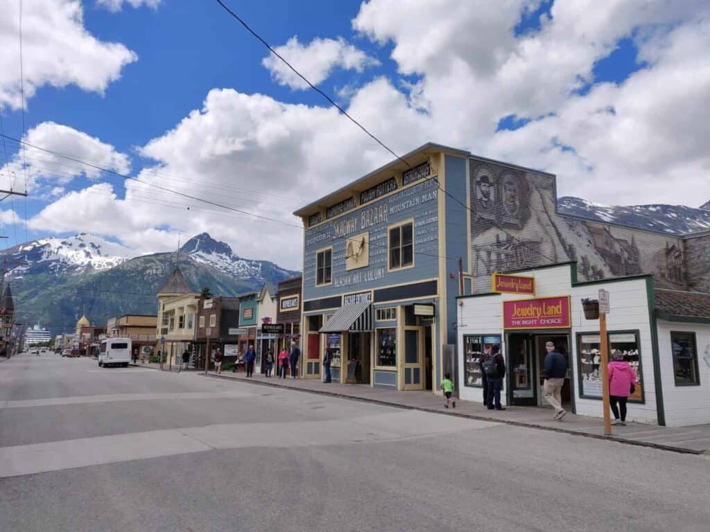
The ferry runs up Lynn Canal to Skagway, where the Klondike Gold Rush began for most stampeders. The historic buildings on Broadway now hold shops, many of them selling gold jewellery and carvings of mammoth ivory found in Alaska. Visit the Gold Rush Cemetery and walk up to Lower Reid Falls. On days when several cruise ships are in port, the town is crowded.
Day 6: White Pass and Carcross to Whitehorse
Skagway to Whitehorse on the Klondike Highway: about 180 km. Fuel at Skagway, Carcross and Whitehorse.
From Skagway and nearby Dyea, the stampeders hauled their gear over White Pass or the Chilkoot Pass in many trips, because the North-West Mounted Police only let them into Canada with about a year’s worth of supplies. To make the trip easier, the White Pass & Yukon Route railway was built over White Pass. By the time it was finished, the rush was largely over. Today it is a heritage railway through spectacular mountain scenery.
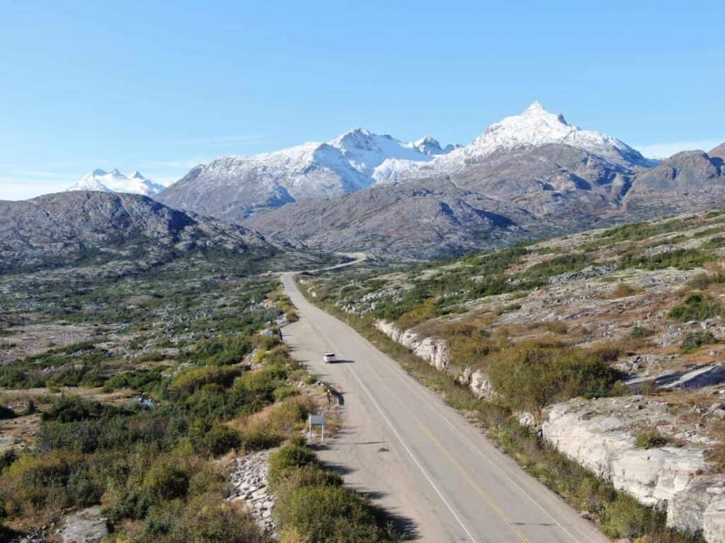
The highway climbs to White Pass and crosses into Canada at Fraser, BC. Stop in Carcross, a Carcross/Tagish First Nation community, and at the Carcross Desert, a field of sand dunes often called the smallest desert in the world. A few kilometres on, Emerald Lake shines turquoise in the sun. On this stretch we saw black bears and marmots.
Day 7: Alaska Highway to Watson Lake
Whitehorse to Watson Lake: 436 km. Fuel at Teslin and Watson Lake.
Heading east, mountains, rivers and lakes line the road. Marsh Lake is really a wide section of the Yukon River, which gives the territory its name and plays a big part on this trip.
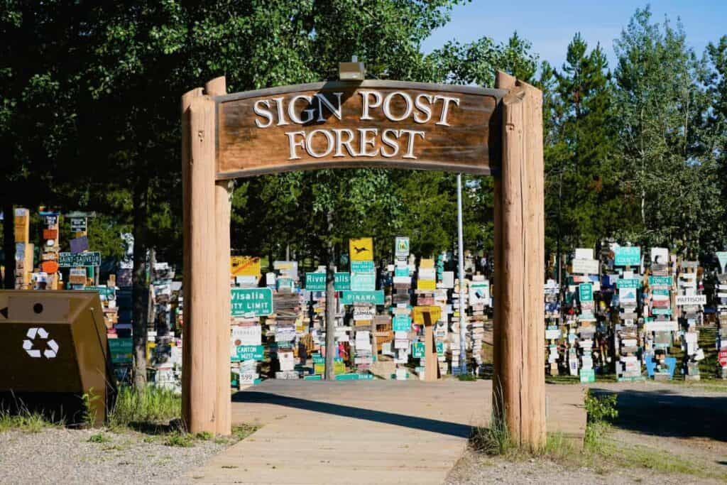
Watson Lake is the first Yukon town for anyone coming up the Alaska Highway from BC. In the Second World War it was an airfield on the Northwest Staging Route. US bombers and fighters stopped here on their way to Alaska, where Soviet pilots took them over for the war against Nazi Germany. The Sign Post Forest started in 1942 with one sign put up by a homesick American soldier. Travel Yukon now counts almost 100,000 signs from around the world.
Day 8: Liard River Hot Springs
Watson Lake to Liard River Hot Springs, BC, and back: about 210 km each way.
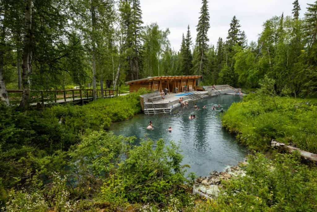
For us, these are the most beautiful natural hot springs in Canada. A boardwalk leads through a warm swamp forest to the pools. Start at the cooler end by the outflow and work your way slowly toward the source, where the water is very hot. BC Parks charges a day-use fee of 5 CAD for adults, 3 CAD for children and 10 CAD for families from May 1 to Thanksgiving, and the pools are open from 7 am to 10:30 pm. Prices in Canadian dollars (CAD), as of October 2026. Watch for bison on the highway.
Day 9: Robert Campbell Highway to Carmacks
Watson Lake to Carmacks: 583 km, a long day. Roughly 60 percent gravel. Fuel at Watson Lake, Ross River (11 km off the highway), Faro (9 km off the highway) and Carmacks. There is no fuel for the first 360 km.
This is one of the longest stages. The Robert Campbell Highway sees little traffic and leads through untouched country, past Frances Lake with its unusual Y shape, and close to the communities of Ross River and Faro. Start early and leave time for wildlife stops.
Day 10: North Klondike Highway to Dawson City
Carmacks to Dawson City: about 355 km. Fuel at Carmacks, Pelly Crossing and Dawson City.
The North Klondike Highway leads into the heart of the gold rush. First come the Five Finger Rapids. Many stampeders lost their boats, their supplies and sometimes their lives on these rocks, and even for the big sternwheelers this was the most dangerous spot between Whitehorse and Dawson City. In the evening you reach Dawson City, the capital of Yukon until 1953.
Day 11: Dawson City and the Klondike Goldfields
The Klondike Gold Rush began on August 16, 1896, when Keish (Skookum Jim), Dawson Charlie and George Carmack found gold on Bonanza Creek. Standing at the creek, with the tailing piles left by a century of mining all around you, it is easy to imagine the work and hardship of those years. Gold is still mined in the Klondike today, with modern equipment.
Dredge No. 4, a huge bucket-line dredge mounted on a pontoon, dug up the creek beds and washed out the gold. Parks Canada runs guided tours from mid-May to mid-September; check times at the visitor centre on Front Street. At a public claim you can try panning for gold yourself. We did not find any.
In the late afternoon, drive up the Midnight Dome for the view over Dawson City and the mouth of the Klondike River on the Yukon. Across the river you can see the Top of the World Highway climbing into the hills. In the evening, the Diamond Tooth Gerties gambling hall puts on can-can shows in summer.
We also took part in a Dawson ritual at the Downtown Hotel: the Sourtoe Cocktail, a shot of whisky with a mummified human toe in the glass. We were served by Captain Dick Stevenson himself, who started the tradition in 1973. The rule is “You can drink it fast, you can drink it slow, but your lips must touch the toe.”
Day 12: Dempster Highway to Eagle Plains
Dawson City to Eagle Plains: 406 km, all gravel. Fill up in Dawson City. Eagle Plains has the only fuel, food and rooms on the Yukon section.
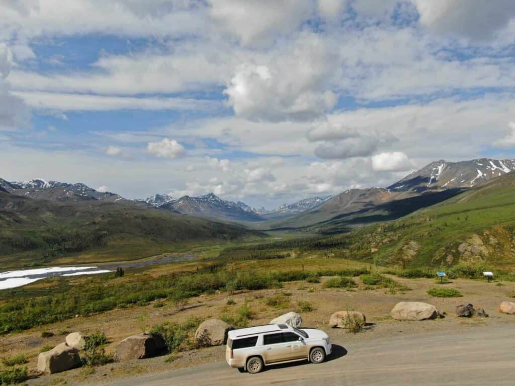
The Dempster turns off the Klondike Highway 40 kilometres east of Dawson City and is the only road between Yukon and the Northwest Territories. It feels more like a well-built farm track than a highway. What struck us most was the silence when the engine was off.
The road is named after William John Duncan Dempster of the North-West Mounted Police. In the winter of 1910 to 1911, a police patrol from Fort McPherson to Dawson City got lost, and all four men died. Dempster led the search party that found their bodies in March 1911. On a warm summer day it is hard to imagine what they went through.
Day 13: Across the Arctic Circle to Inuvik
Eagle Plains to Inuvik: 367 km. Fuel at Fort McPherson and Inuvik. Two free ferries: the Peel River (km 539) and the Mackenzie River at Tsiigehtchic (km 608), usually from June to October.
A few kilometres north of Eagle Plains, at kilometre 405, you cross the Arctic Circle. We toasted it with a glass of sparkling wine. Soon after, you leave Yukon, cross the Richardson Mountains and descend toward the Mackenzie Delta. In Fort McPherson, the members of the Lost Patrol are buried in the cemetery. After the ferries over the Peel and the Mackenzie, you reach Inuvik.
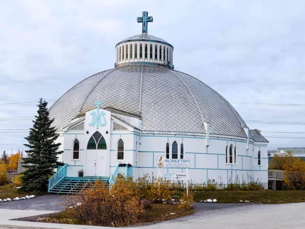
In Inuvik, take a look at Our Lady of Victory Church, the igloo-shaped church designed by Maurice Larocque. It is the town’s landmark.
Day 14: To Tuktoyaktuk and the Arctic Ocean
Inuvik to Tuktoyaktuk and back: 138 km each way on gravel.
The Inuvik to Tuktoyaktuk Highway opened in November 2017 as the first all-weather road to Canada’s Arctic coast. Building it on permafrost was a huge effort. Along the way you see pingos, hills with a core of ice that the permafrost pushes up out of the flat tundra.
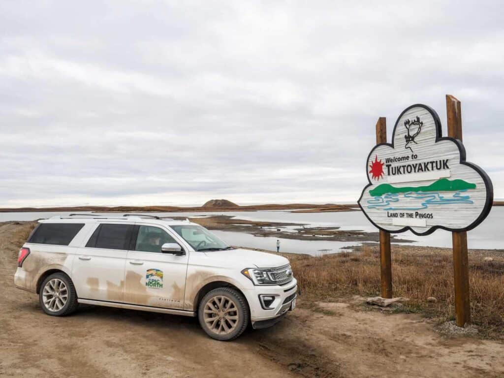
Then you stand on the shore of the Arctic Ocean, a long way from the Pacific. We took off our shoes and waded in for a quick selfie. After this trip, dipping just a big toe did not seem like enough. Our feet tingled for a long time afterwards.
Day 15: Fly Back to Whitehorse
Drop off the car in Inuvik and fly back to Whitehorse with Air North. Spend a last evening in the capital before you head home.
What stayed with us most were the people we met, from Haines to Tuktoyaktuk, and the landscapes, which are beautiful and also fragile. The north is warming faster than most of the planet, and on this trip you see it in the glaciers, the rivers and the permafrost.
Doing It as a Guided Tour
We travelled with EPIC NORTH Tour Experiences, a Whitehorse operator. Its 15-day guided trip “From the Pacific to the Arctic Ocean” is listed on Travel Yukon (opens in a new tab). Contact the operator for current dates and prices.
Frequently asked questions
How long does it take to drive from Whitehorse to Tuktoyaktuk?
The direct route via the Klondike, Dempster and Inuvik to Tuktoyaktuk highways is about 1,450 kilometres and takes at least three long days. This 15-day loop adds the Pacific coast, Watson Lake and the Robert Campbell Highway, for about 3,600 kilometres in total.
When is the best time for this road trip?
Late June to late August. The Dempster ferries usually run from June to October, but the river crossings close during freeze-up in autumn and break-up in spring. Snow can fall on the Dempster in any month.
Do I need a passport?
Yes. Days 3 to 6 take you into Alaska via the Haines Road and back into Canada via the Klondike Highway at Fraser.
Can I rent a car in Whitehorse and drop it off in Inuvik?
Some companies allow one-way rentals and gravel driving, many do not. Ask about one-way fees and whether the Dempster and the Robert Campbell Highway are permitted before you book.
Where can I get fuel on the Dempster Highway?
Fill up in Dawson City. The next fuel is at Eagle Plains (km 369), then Fort McPherson (km 550) and Inuvik.
Comments
No comments yet. Questions about this article are welcome.
Thank you. Your comment will appear once we have checked it.